Off Track Betting, Poughkeepsie, NY

This building is located at 611 Dutchess Turnpike (Route 44), Poughkeepsie, NY.  This Off Track Betting site was vacant for quite some time.  In 2015 the building was being renovated to become the home of Darkside Records; those photos are from June and October.  The murals that decorated the outside of the building were covered up during the renovation.

Location:  Google Maps (41.696520, -73.892017)

Torpedo Boat, Poughkeepsie, NY

The USS Blakely and USS Shubrick were Blakely class torpedo boats constructed in 1899. They served in various capacities until 1920 when they were both sold for scrap to U.S. Rail and Salvage Co. in Newburgh, N.Y. The cut off bow of one of these vessels was then used as land fill in Poughkeepsie south of the Mid-Hudson Bridge.  These are photos of the boat.

More information: USS Shubrick, USS Blakely

Location:  Bing Maps (41.690041, -73.938759)

Vanderburgh Burial Ground, Poughkeepsie, NY

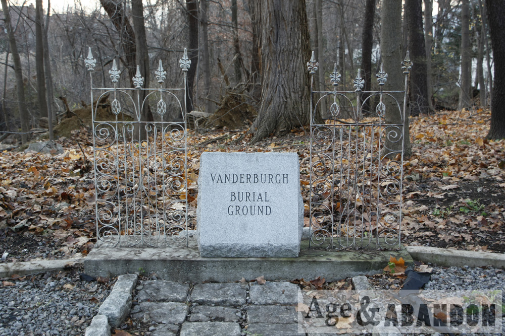
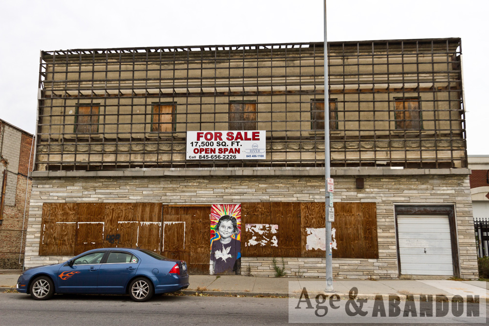
This family cemetery is located on Cedar Avenue in Poughkeepsie a little south of the intersection with Hooker Avenue.  It is in front of the Fox Hill Condo complex, between Panorama Blvd and Arnold Blvd on the west side of the road.  There is an entry on the RootsWeb website that digitizes an entry in “Old Gravestones of Dutchess County, New York” by J. W. Poucher published in 1924, page 238.  Below is the information from the website/publication:

CLASSIFICATION: Family ground.
LOCATION: Southeast of the city of Poughkeepsie, in an orchard near the east fence of the property of the Hudson River Driving Park Association.
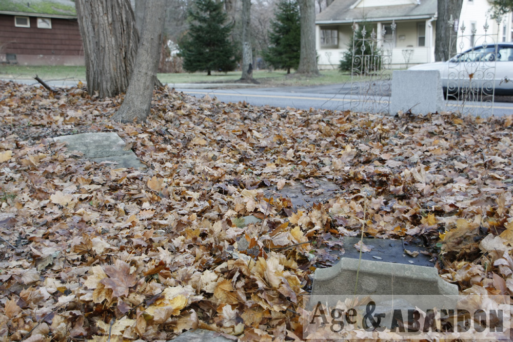
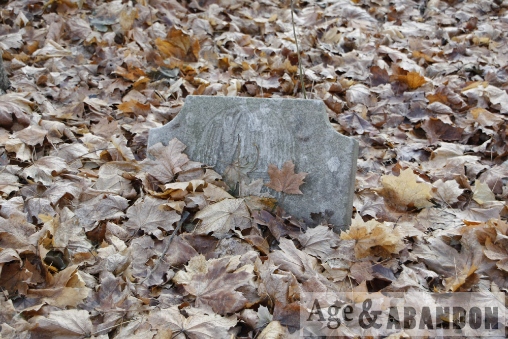
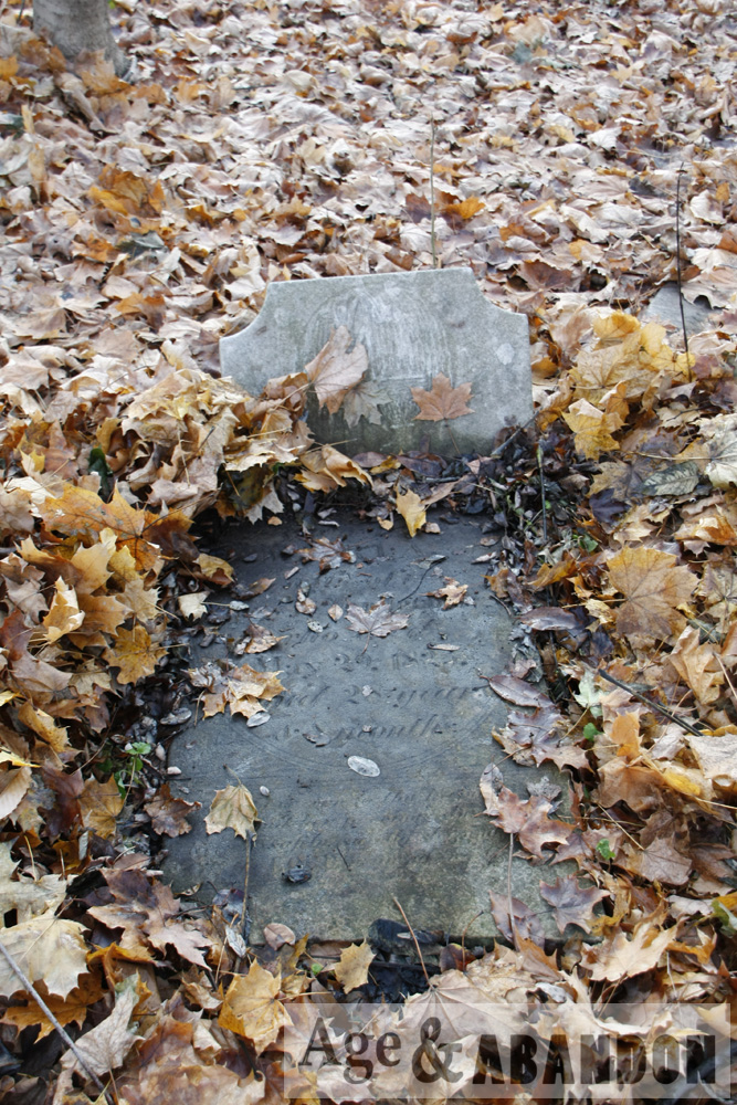
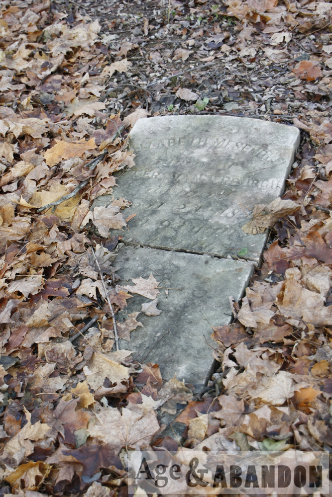
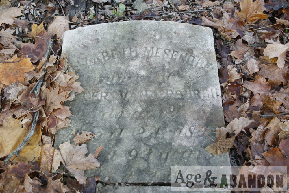
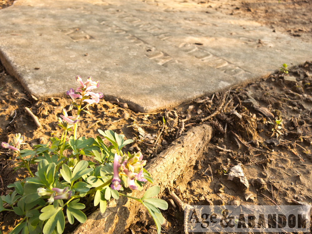
CONDITION: Stones fallen and broken.
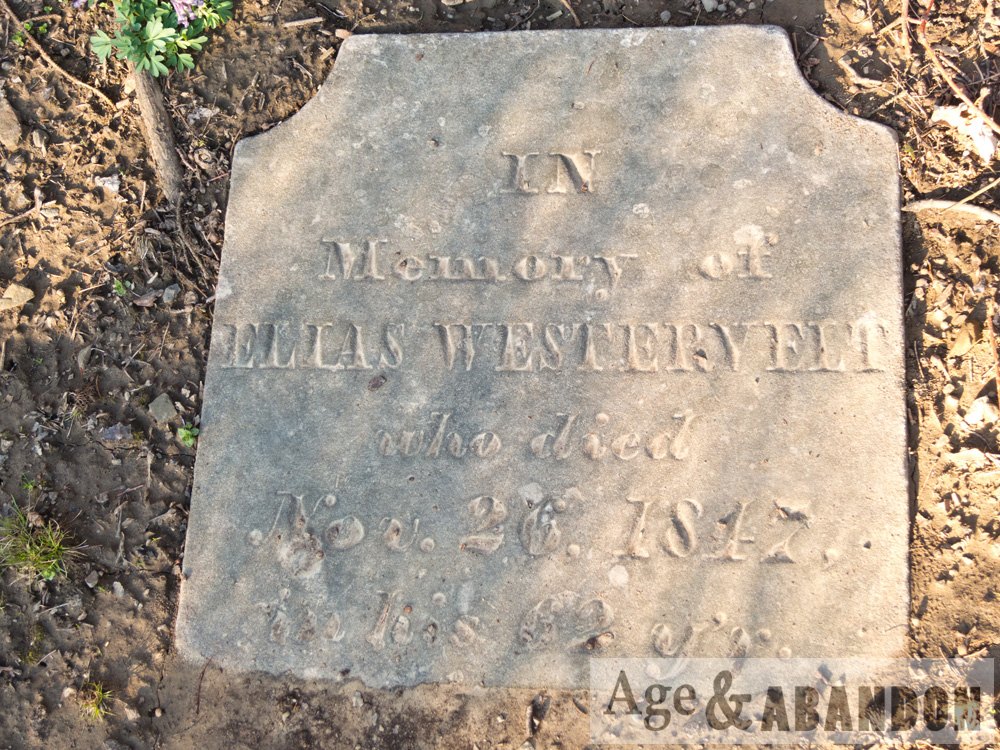
INSCRIPTIONS: 9 in number. Copied April 25, 1911, by J. W. Poucher, M. D., and Miss Helen W. Reynolds.
REMARKS: Van Der Burgh ground. Before 1800 the Van Der Burghs were large land owners in this neighborhood and on old maps the present Southeast Avenue, Poughkeepsie, was “the road to John Van Der Burgh’s”. John Van Der Burgh’s house is still standing opposite the northeast corner of the Driving Park but made over and modernized. In its first estate it was an attractive eighteenth century farm house with an excellent carved doorway and fanlight. Originally there were a good many stones in the family burial ground which, by vandalism, have been broken and scattered.

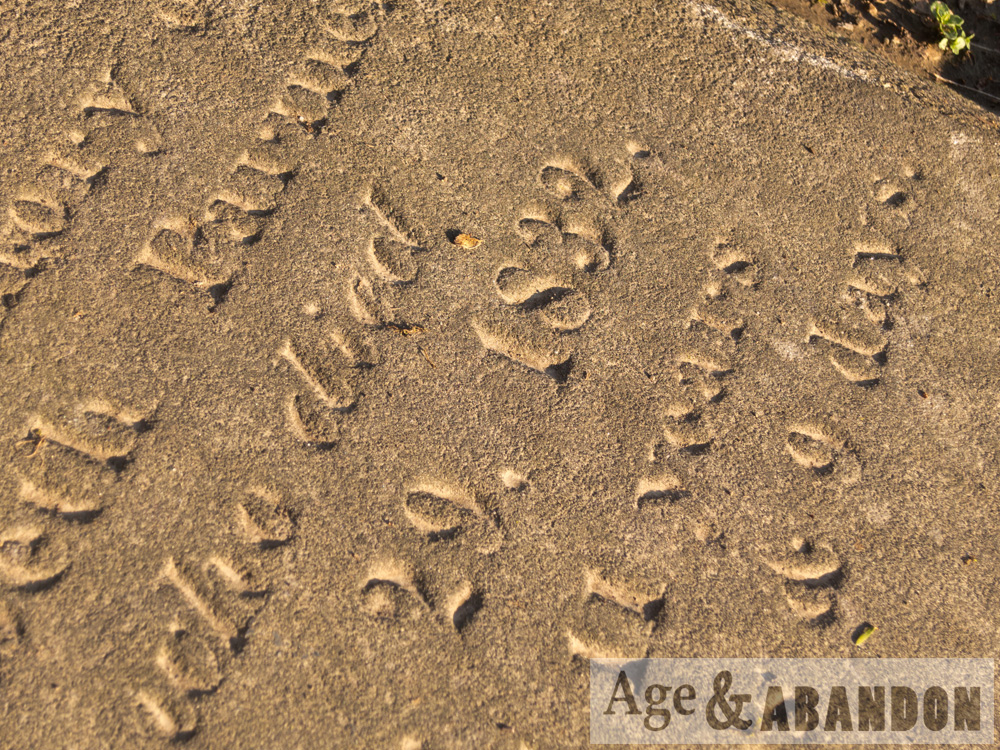
1. Burton, Abigail, w. of Stephen, d. 1850, Oct, —-, a. 82 y. 2 m.
2. Burton, Stephen, d. 1842. (Broken stone).
3. Vanderburgh, Abraham, d. 1840, Nov. 23, a. 60 y. 9 d.
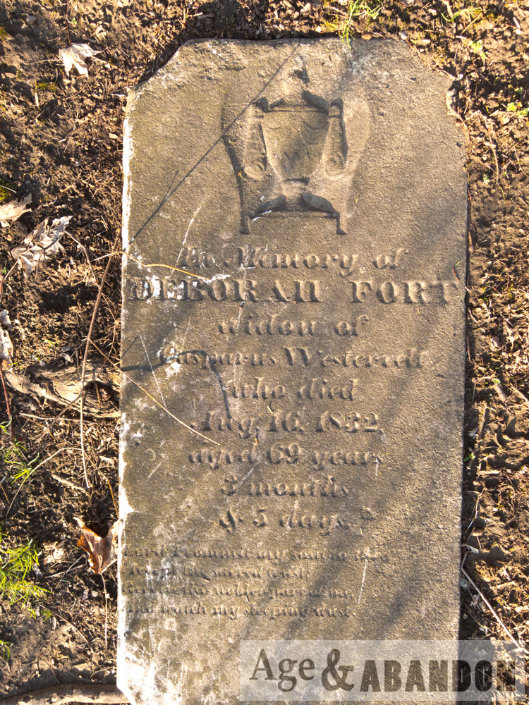
4. Vanderburgh, Elizabeth Meserole, w. of Peter, d. 1842, Apr. 24, a. 93-6-7.
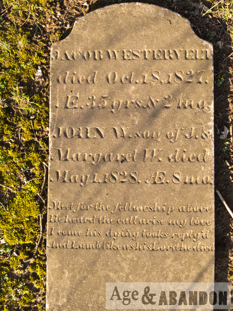
5. Vanderburgh, Henry, d. 1821, Nov. 9, in 82d y.
6. Vanderburgh, Maria, w. of Henry P., d. 1823, May 29, a. 28 y. 8 m.
7. Vanderburgh, Peter, d. ——–. (Broken)
8. ————, d. Dec. 15, ——-, a. 81-8-24.
(Broken stone, possibly part of Peter Vanderburgh’s).
9. ————, “March —, a. 75 y. 1 m.” (broken stone).

More information:  RootsWeb entry

Location:  Google Maps (41.681472, -73.903283)

Vassar Farms, Poughkeepsie, NY

Photos of some of the agricultural buildings on the property known as Vassar Farms, owned by Vassar College, in Poughkeepsie, NY.  Since these photos were taken, they renovated a portion of the main barn (dairy wing).  According to the website for the Environmental Cooperative, Vassar College purchased the property in the early 1900s and moved its farming operation, which supplied much of the food for the college, from the main campus to this nearby property.  This move of operations “necessitated the construction of a poultry farm, stables, greenhouses, storage barns, and a model dairy barn. By the 1950s, the farming operation was no longer economically viable; all of the cows were sold, and the Vassar Farm stopped producing its own vegetables and milk products.”

More Information:  The Environmental Cooperative at the Vassar Barns

Location:  Google Maps (41.678131, -73.897138)

Sunnyridge, Route 55, Poughkeepsie, NY

There are several storefronts constructed to the front of this older residential structure on Route 55 in Poughkeepsie.  Based on a Facebook post in a Pougkeepsie-related group, this strip included Becks Farm Market, Karl Ehmer’s Meats, and Harold’s Drive-In in the late 1960s/1970s.  The historic photos are courtesy of Tom Beck (digitized from 8mm home movies) who posted these to Facebook and dated them from about 1965.

Location: Google Maps (41.688145, -73.881044)

Former Trolley Building, Poughkeepsie, NY

The building at 489 Main Street, Poughkeepsie, NY was the home of the City Horse Railway from 1874 to 1894, when it was rebuilt for the electric trolley system. The trolley system closed in 1935, and was replaced by buses. Diesling’s occupied the building from 1956 to 1994. Plans are underway to create an art center in the building.

Location: Google Maps (41.701565, -73.919235)

Poughkeepsie Underwear Factory, Poughkeepsie, NY

The Poughkeepsie Underwear Factory building is located on North Cherry Street just north of Main Street in Poughkeepsie, NY.  The building was built in 1874 and contained several operations throughout its existence.  Below is some history, taken from a Poughkeepsie Journal article:

The building was originally occupied by William S. Patten’s Poughkeepsie Live Oak Leather Manufactory.  Afterwards, it was transformed several times to accommodate a cooperage, a paper mill, and the Poughkeepsie Underwear Factory.

In 1887, when the factory was used by the Dutchess Manufacturing Co., the structure was expanded to almost double in size.

A barrel-manufacturing operation named William Paulding’s Cooperage moved into the building in 1895 and remained there until 1902.

In 1902, the building became the Poughkeepsie Underwear Factory.  This business operated until the 1920s.  After, a paper mill briefly occupied the building.

“The building boasts one of the earliest elevators to exist and it is still intact,” said Elizabeth Celaya, director of organizational development for Hudson River Housing Inc., which acquired the structure in May 2012.

Since these photos were taken, the building has been renovated as mixed-use space with two thirds consisting of apartments and one third planned as a commercial community hub, which was opened in 2017.

More information:  Poughkeepsie Journal article, Underwear Factory website

Location:  Google Maps (41.701587, -73.917948)

Former Arthur S. May School, Poughkeepsie, NY

This school was most recently known as the Arthur S. May Elementary School.  Previously it was simply the Arlington Elementary School, and it was originally the first high school for the Arlington Central School District.  The building was built in 1924.  The school is located on Raymond Avenue in Poughkeepsie, NY.  The school district stopped using this location in June 2014 and moved the name of the school (Arthur S. May) to a nearby building.  The property is now for sale, as of 2017.

I particularly liked photographing the “Boys” and “Girls” entrance signs, and also the various staircases throughout the building.  It was kind of sad to read the final goodbye notes on the white boards, especially the principal’s (“pack my office”).

Location:  Google Maps (25 Raymond Avenue)

Westervelt Family Cemetery, Poughkeepsie, NY

The family cemetery for the Westervelts is located on Route 9 (a.k.a. South Road or Albany Post Road) in Poughkeepsie, NY just north of IBM road, cattycorner to the location of the building known as the Westervelt house, which was demolished in 2017 and the property is being redeveloped as a bank.

Unfortunately some vandalism has occurred at the cemetery property.  Please be respectful of the property and to those who are buried there!

Location: Google Maps (41.652050, -73.928717)