Old Dixie Highway, Espanola, FL

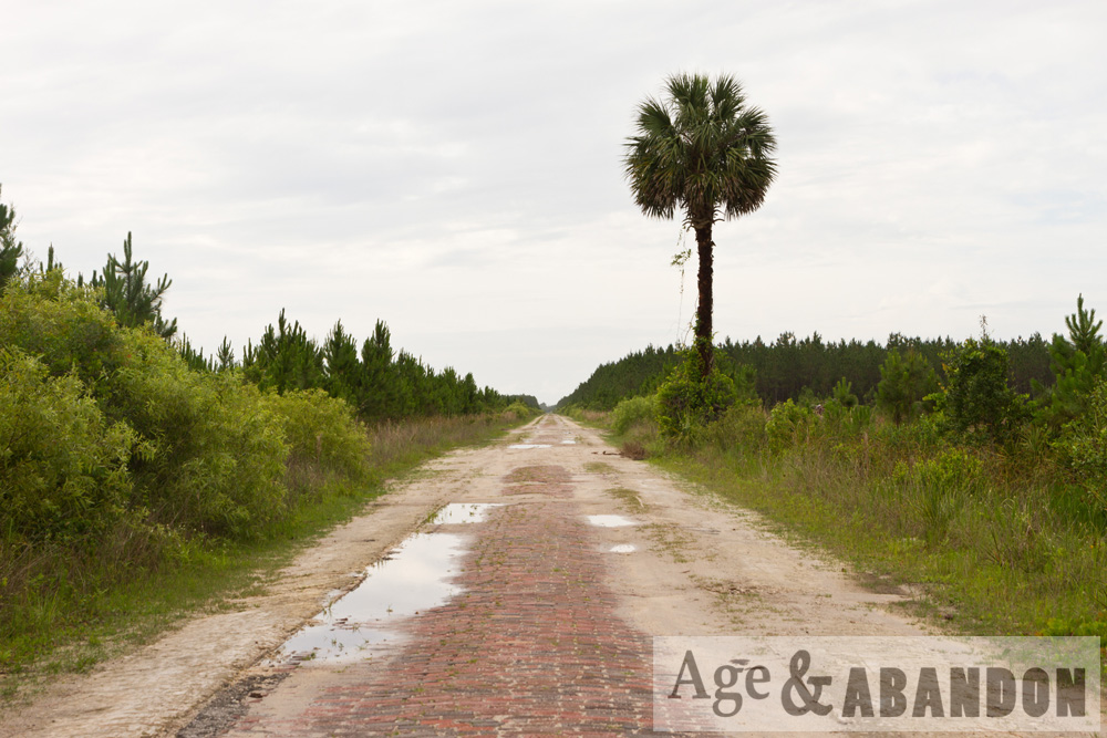
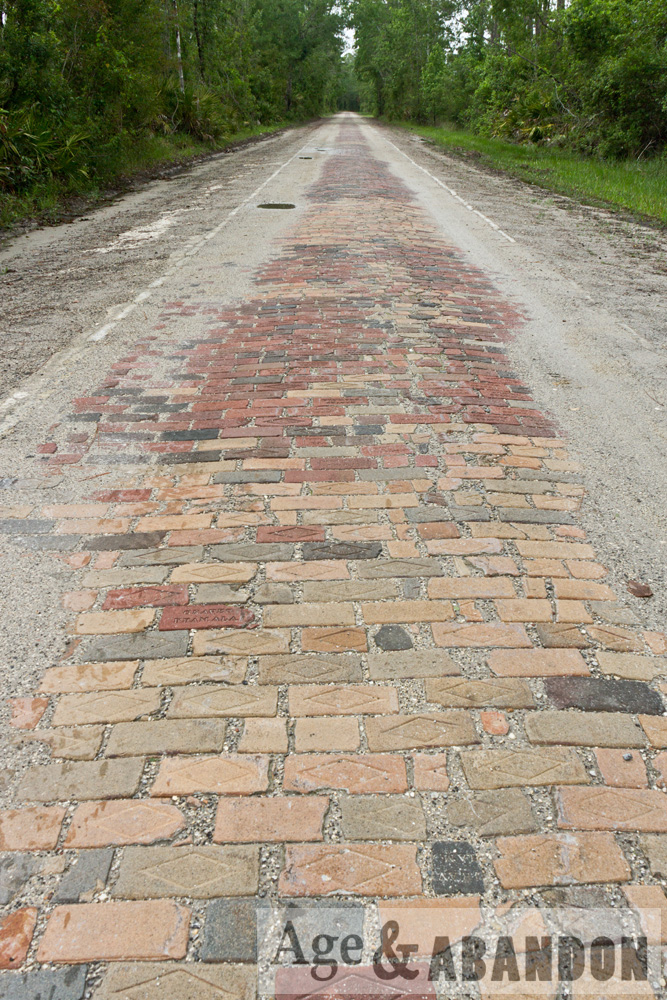
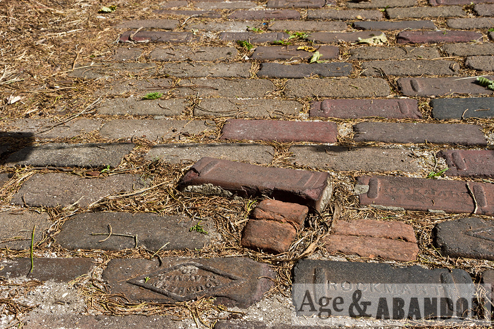
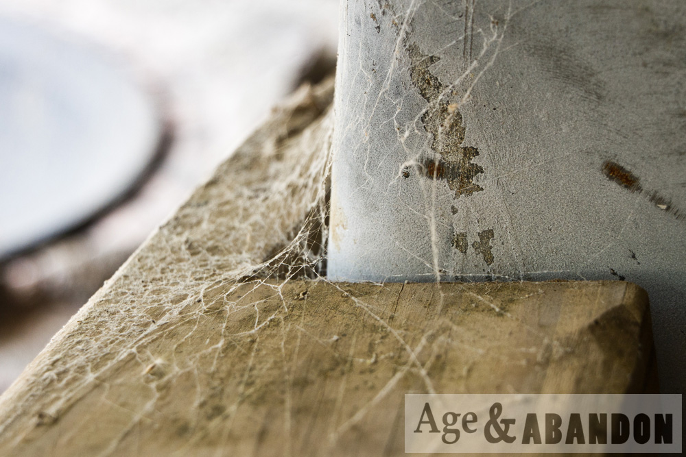
These photos are of a ~10-mile section of the Old Dixie Highway (also known as “Old Brick Road”) that remains single-lane and lined by brick and starts in Espanola, FL (a small town northwest of Bunnell) and continues north to CR-204.  The road is about 9 feet wide and flanked on either side by a concrete curb.  There are wide shoulders on either side that also appear to be made of concrete.  The lands on either side of the road are tree farms, and you will see various gated logging roads on either side.

These photos were taken May 2018, after several rain storms.  Sections of the road were mostly covered by sand.  I was able to traverse it in a 2-wheel-drive Ford Fusion, just as long as you are careful about the potholes and sandy areas.  You cannot really travel faster than 10 mph, so expect it to take 1 hour to traverse the entire route.

More information about the road can be found at the Florida Backroads Travel website, and is summarized here:

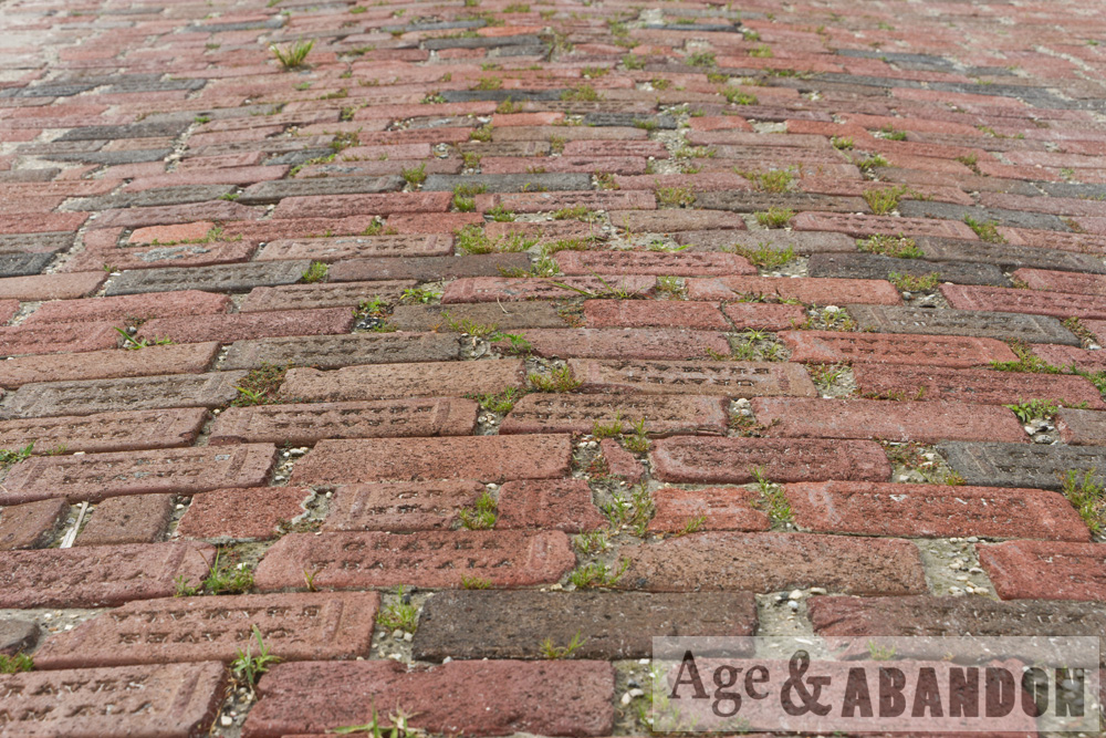
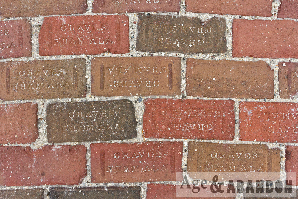
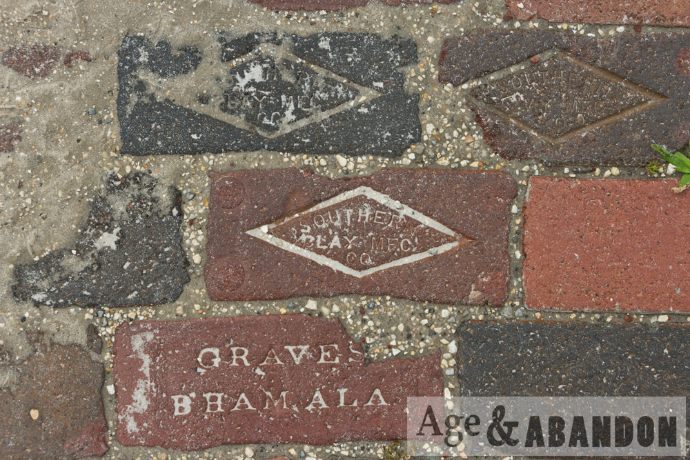
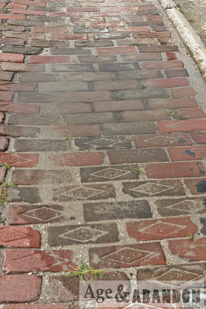
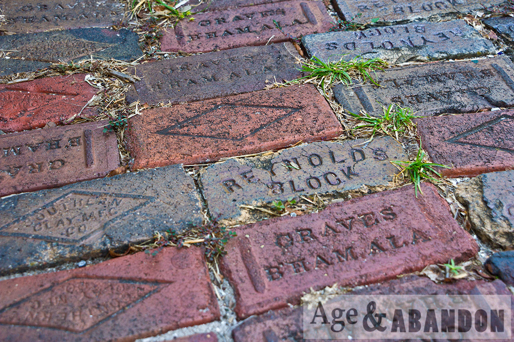
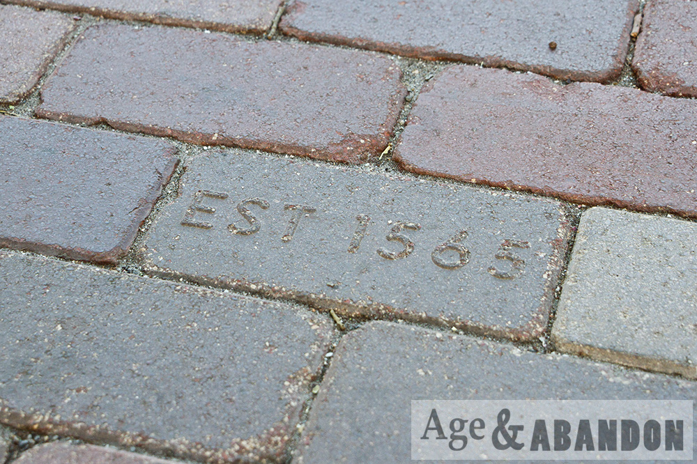
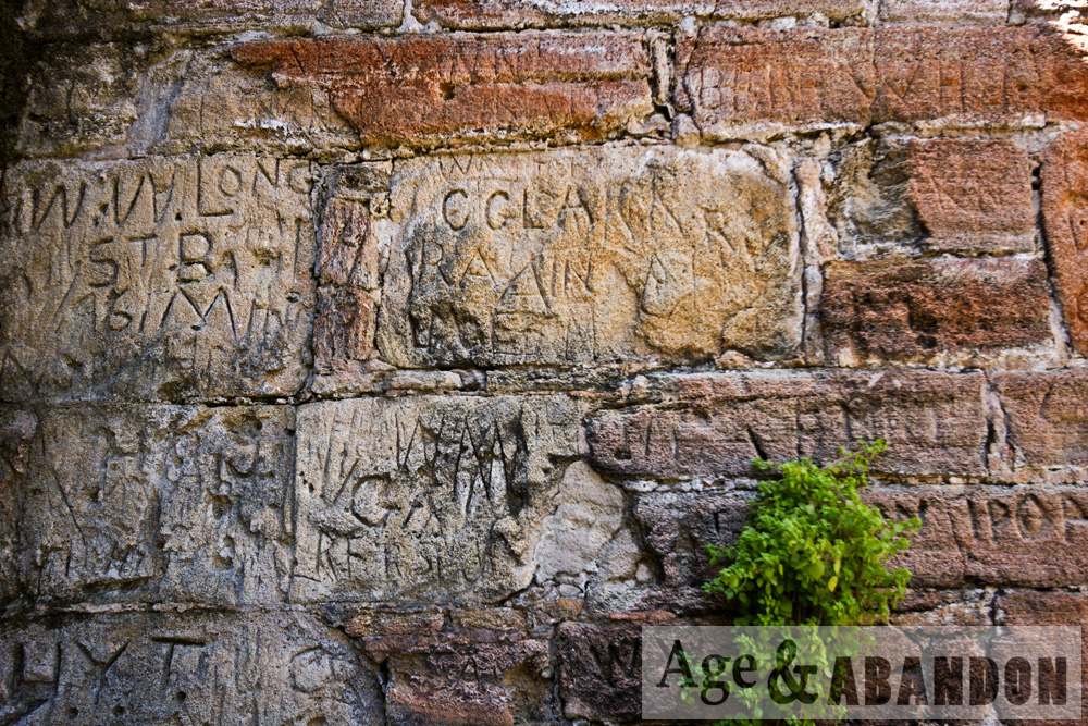
This red brick is the original pavement of the Dixie Highway. Construction began in 1915 on the highway. Many of the bricks were manufactured by the Graves Company of Birmingham, Alabama.

The Dixie Highway was a system that connected Chicago to Miami. You can see vestiges of this system all over the eastern part of Florida in the name “Old Dixie Highway”.

This segment was part of a road designed to connect Jacksonville with the area around Flagler Beach east of Bunnell. Most of Old Dixie Highway was torn out and paved over with asphalt in the 1920s and 1930s. The old brick road that ran from Bunnell to Flagler Beach was torn out and repaved and became State Road 100. A lot of bricks from the old road were given to local settlers who used them for their own paving projects, fireplaces or patios.

Espanola’s heyday was a long time ago. When the highway was new, the little town boasted of a hotel, restaurant, barber shop and post office. When what is now U.S. Highway 1 was completed from St. Augustine to Bunnell in 1926, people stopped using the Old Brick Road and Espanola faded away to its present condition of a few old homes and small farms.

Southern entrance: 29.517923, -81.312343
Northern entrance: 29.651671, -81.379915

Ponce de Leon Lighthouse, Ponce Inlet, FL

Here is some history of the lighthouse, taken from their website:

The Ponce de Leon Inlet Lighthouse began as the Mosquito Inlet Lighthouse with the purchase of ten acres of land on March 21, 1883.  Construction occurred from 1884 to 1887.  The tower was lit with a kerosene lamp in a first order fixed Fresnel lens.  In August 1933, the tower light was electrified with a 500 watt electric lamp and the original first order fixed lens was replaced by a third-order revolving, flashing lens.  In late 1953, the lighthouse was completely automated.

In 1970, the Coast Guard abandoned the old Light Station and established a new light at the Coast Guard Station on the south side of the Inlet. Vandals did much damage to the Light Station, but two years later as the result of work by concerned citizens,, the abandoned property was deeded to the Town of Ponce Inlet.

In 1972, the Ponce de Leon Inlet Lighthouse Preservation Association was founded as a non-profit, organization to restore and operate the property as a museum.  Through the efforts of the dedicated volunteers of the Preservation Association, the damage done by vandals was reversed and full restoration was begun.  The Ponce de Leon Inlet Lighthouse is now listed as an operational private aid to navigation.

More information:  Lighthouse website

Location:  Google Maps (29.080629, -80.928045)

WWII Submarine Observation Tower, Ormond-By-The-Sea, FL

These are photos of a World War II era coastal watch tower that was used to spot German submarines.  This is one of many such towers that were built along the eastern coastline.  The tower was recognized as a historic site in the mid 1990s and refurbished in 2005.

More information: Ormond Beach Historical Society

Location: Google Maps (29.346930, -81.065100)

Abandoned Commercial Building, Daytona, FL

I found this abandoned building along Route 4009 (4015 South Williamson Blvd) in Daytona, FL.  The building appears to have been a commercial building.  I was attracted by the scaffolding-like entry.  The only piece of information I could find for the history of the building was an old real estate listing indicating the building was built in 2006 and is a “partially completed church building”.

Location: Google Maps (29.137250, -81.051817)

Port Orange Train Depot, Port Orange, FL

According to Wikipedia, this site is the Port Orange Florida East Coast Railway Freight Depot (also known as the Central Pump & Supply Company) in Port Orange, FL. The station was originally built in 1894, and was used as a flag stop as late as 1955. In 1966, it was relocated 500 feet north of its original location. On February 5, 1998, it was added to the U.S. National Register of Historic Places.

More information: Website

Location:  Google Maps (29.143917, -80.993050)

Florida Agricultural Museum, Palm Coast, FL

From their website, “Learn about Florida’s farming history, rare heritage livestock, native plants and wildlife. Rare cracker horses and cattle, descendants of the first Spanish settlers’ livestock, make their home at the Museum. Learn about the history of the Museum and the authentic structures relocated onto the Museum grounds and carefully restored. The Museum’s farm showcases an abundance of native Florida plants and wildlife.

More information: Website

Location:  Google Maps

Bulow Plantation Ruins Historic State Park, Palm Coast, FL

The Bulow Plantation grew sugar cane, cotton, rice and indigo until 1836 when the Second Seminole War swept away the prosperous plantation.  Ruins of the sugar mill, a spring house, and the crumbling foundations of the plantation house remain. The mill ruins are listed on the National Register of Historic Sites.

Park website: https://www.floridastateparks.org/park/bulow-plantation

Dunlawton Sugar Mill, Port Orange, FL

The Dunlawton Sugar Mill was established in 1832, was pillaged during the Second Seminole Indian War, restarted again in 1847, and then soon failed again.  The Mill was left in ruins.  From 1948 to 1952, the land was operated as Bongoland, which included a baboon (the namesake of the park), a replica Seminole village, a miniature train that took visitors around the park, and “prehistoric monsters” (dinosaurs) of concrete.  The land is now operated as a botanical gardens, and includes the Mill ruins and the remaining concrete dinosaurs.

Information about Bongoland:  http://www.abandonedfl.com/bongoland/

Botanical Gardens website: http://www.dunlawtonsugarmillgardens.org/index.html

Location:  Google Maps