An abandoned farmstead was hidden in the woods across from the Culinary Institute of America in Hyde Park, NY. Logging activities in May 2015 revealed these ruins after approximately 30 years of abandonment. Historic mapping seems to indicate the property was initially developed in the mid 1800s. A stone tower on the property would have had a great view of the Hudson River when the property was cleared.
In 1987, the NYS Department of Transportation was planning some work on the adjacent Route 9 (PIN 8040.86), so the portion of this property closest to the road (identified as “Site E”) was surveyed for cultural/historic resources. In that survey report, the portion closest to Route 9 is indicated to be a “gradually prospering farmstead” and orchard site from the nineteenth century into the twentieth century. It was determined to be “possibly originally constructed before 1850, but certainly not before 1820… The site was definitely occupied into the twentieth century but the exact date and cause of abandonment is unknown”.
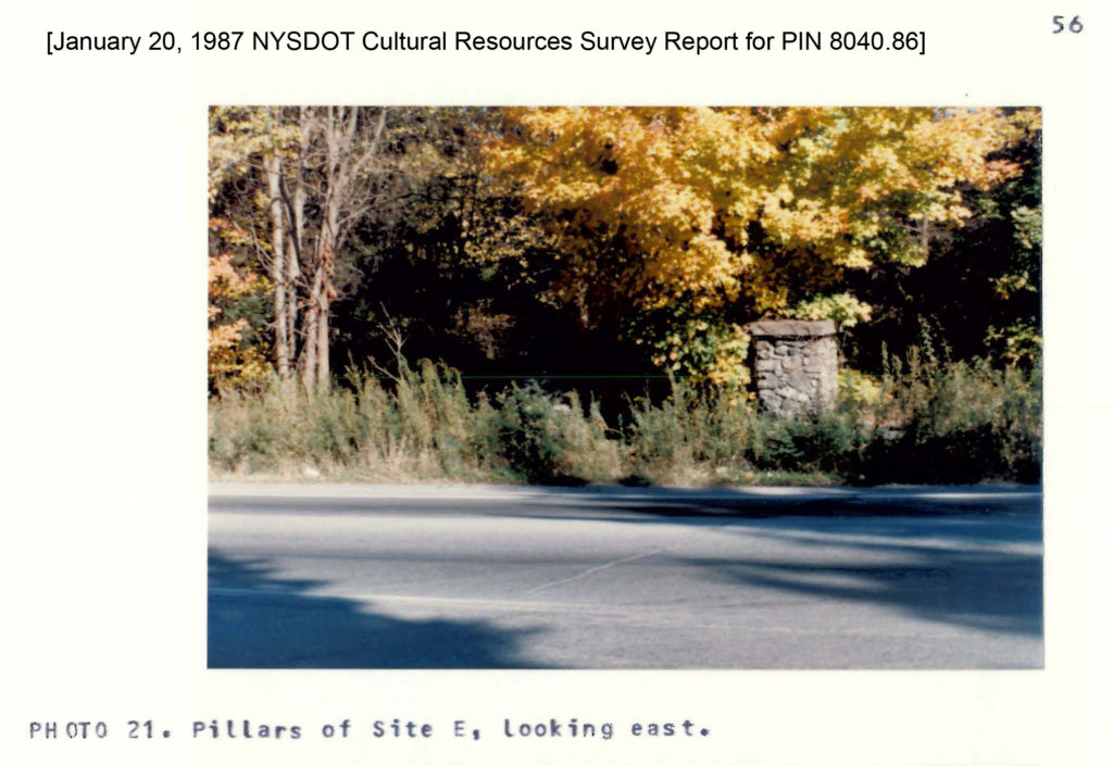
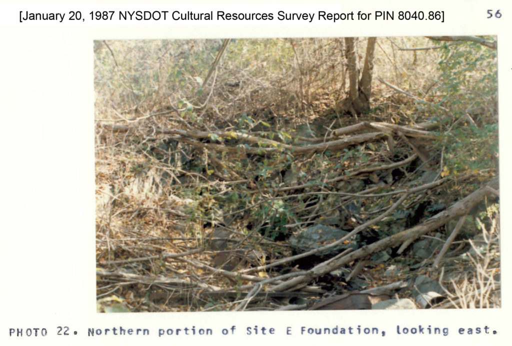
In the 1987 report, a pair of stone pillars in a fieldstone wall was located at the entrance to the site, across from the entrance to the Culinary Institute of America (CIA); see Map 8 and Photo 21 from the report. (These pillars were likely destroyed when work was completed along Route 9.) A dirt road lead from the pillars slightly northeast (188 feet north and 166 feet east) to the subsurface fieldstone foundation of a house (see Photo 22 of the report). Investigation of the house foundation indicated that it was composed of three sections, each of which appeared to reflect a later addition. The artifacts found in the additions show an increasing wealth of the residents of the property over time.
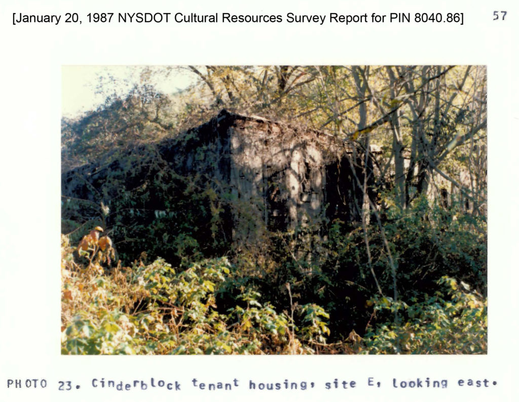
Behind the fieldstone house was “an extensive apple orchard and a large narrow cinderblock building”. The cinderblock building (see Photo 23 of the report) was segmented into five “compartments each with its own fireplace and was probably housing for seasonal tenant workers”. The cinderblock building was still present when I photographed the property in 2015.
Between 2005 and 2008, additional cultural resource surveys were performed on the site. More extensive historic research was performed for these surveys than the 1987 one. The site was identified as primarily farmland during the 18th and 19th centuries, part of several family farms (Stuyvestant, Osborne, Butler, Jones, and Webendorfer). The foundation remains of a 2-section house parallel to Route 9, presumed to have been constructed around 1783 and identified as the Walton Roosevelt House, were found on the site along Route 9. (I did not photograph these ruins.) The foundation and cobble floor of a 19th century barn, once part of the Webendorfer family farm, was also identified. (I did not photograph this ruin either.)
Starting in the 1890s, the Jesuit Society purchased these family farms on the west and east sides of Albany Post Road (Route 9) for the training of priests, the St. Andrews Novitiate. The east side of Route 9 was redeveloped as farmland, orchards, and vineyards to support the Jesuit community, which included the construction of winery buildings, agricultural buildings, and roads. A 1950s map of the property (included in my gallery here) was included in the survey reports. The tile building I photographed was a piggery and the tall tower building was used as a water tower. The long, white “tenant building”, perpendicular to Route 9, is shown on the map, but not specifically identified as a certain use. By the late 20th century, the east side of Route 9 was no longer being used by the Jesuit community and it was sold in the 1960s.
1986 Historic Survey link: Click here
Map: Aerial view